
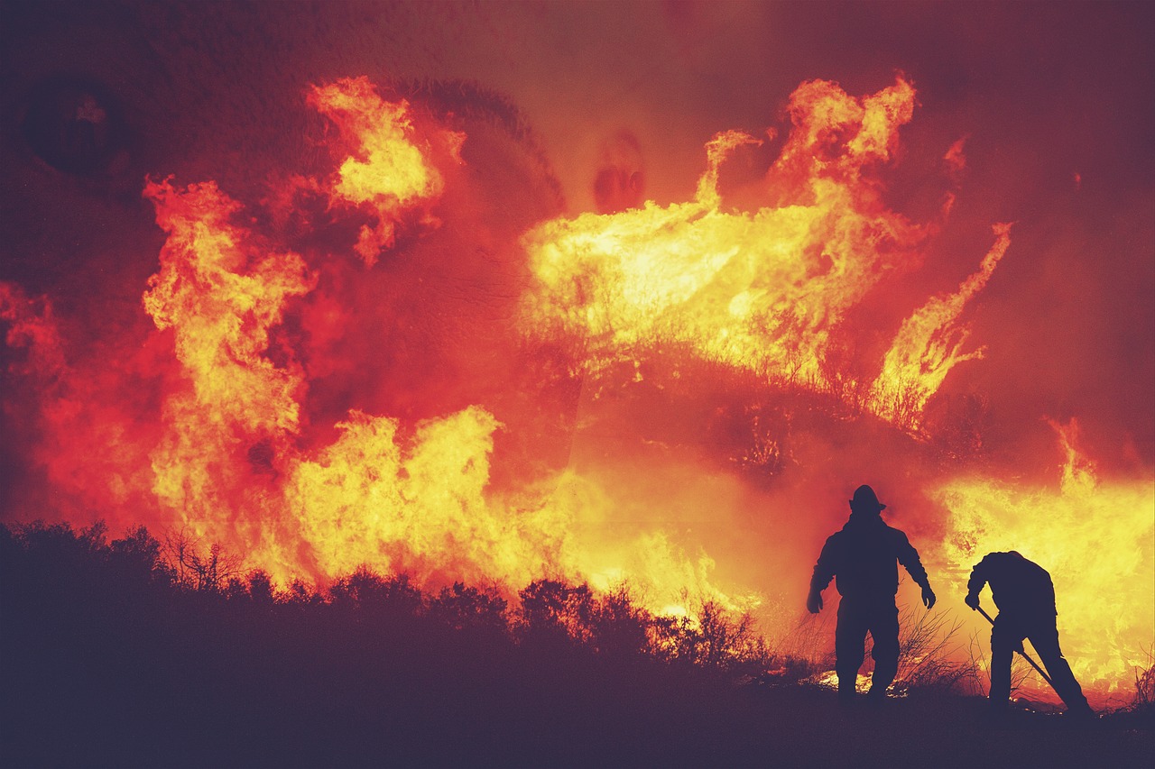
Every year, billions of dollars are spent on fighting wildfires, protecting the trees, natural habitats, infrastructure and, of course, people. By using AI to enhance wildfire detection, we can significantly lower wildfire risks by enabling us to detect and extinguish them in their early stages, before they have a chance to spread out of control. By reducing reaction time, we can not only mitigate the risk but also save costs – extinguishing a small fire requires dramatically fewer resources than trying to contain a megafire.
Predicting wildfires with the help of AI
Currently, fire risk is determined predominantly based on weather information obtained from satellites and (where available) enhanced with data from local weather stations. Fire risk is then calculated on a rather coarse scale (e.g. with 1km2 resolution) and published on news channels to alert the public of a heightened threat by wildfires.
Calculating fire risk levels taking into account various sources of information (satellite, weather stations and potentially local sensors) and then mapping the risk on a fine-grained scale is a complex and tedious task which can be automated and enhanced in accuracy and resolution with the help of AI. Of course, adding more fine-grained information such as soil and air moisture levels measured by sensors embedded in the forest would help to take into account the microclimate of the forest. In the future, we might be able to push this even further if we could find a technical solution for measuring the fuel moisture (grass and needles), rather than just the soil moisture.
The machine-learning models used for fire detection are trained on large datasets that include both fire and non-fire scenarios to accurately identify fires based on the characteristics of smoke and other factors. The models are also rigorously trained to reduce the prevalence of false-positive fire alerts.
Cameras and AI
Camera detection works by using a camera on a watchtower overlooking a large area of forest. Traditionally, these watchtowers were manned by people keeping a lookout, but are increasingly being monitored by cameras.
Machine learning and AI image recognition can be used to identify the presence of smoke or fire plumes rising above the canopy. Image-recognition technology has been around for some time and has proven to be effective in various applications. In the context of wildfire detection, cameras are used to capture images of the forest above the canopy and analyse them for the presence of smoke. However, this method faces several challenges.
One of the main challenges with camera-based detection is the occurrence of false positives. Agricultural machinery might throw up dust during field ploughing, for example, and even wind farms can be mistaken for smoke plumes from a large distance. Weather conditions, such as haze or fog, can also make it difficult for cameras to accurately identify smoke, and the time of day, particularly dawn, dusk and night-time, can affect the visibility of smoke in images.
By continuing to improve machine-learning algorithms with more data, AI-enabled camera detection can reduce false positives and improve the accuracy of smoke detection. However, a key restriction remains that cameras typically cannot see what’s happening under the tree canopy and only detect smoke plumes once they are rising above the tree canopy. This is an important limitation as most human-induced fires start at the forest floor and smoke only breaches the canopy once the fire underneath has already grown quite large. The process can take up to several hours from ignition, in particular if the fire starts as a smouldering fire, e.g. as a result of a discarded cigarette. The delay in detection can mean that by the time fire crews arrive on the scene, they are facing a dangerous job trying to contain the fire. While infrared technology could help to complement the shortcomings of optical cameras, the resolution of these camera systems is typically too low to provide usable images for detecting fires at a great distance.
Gas sensors and AI
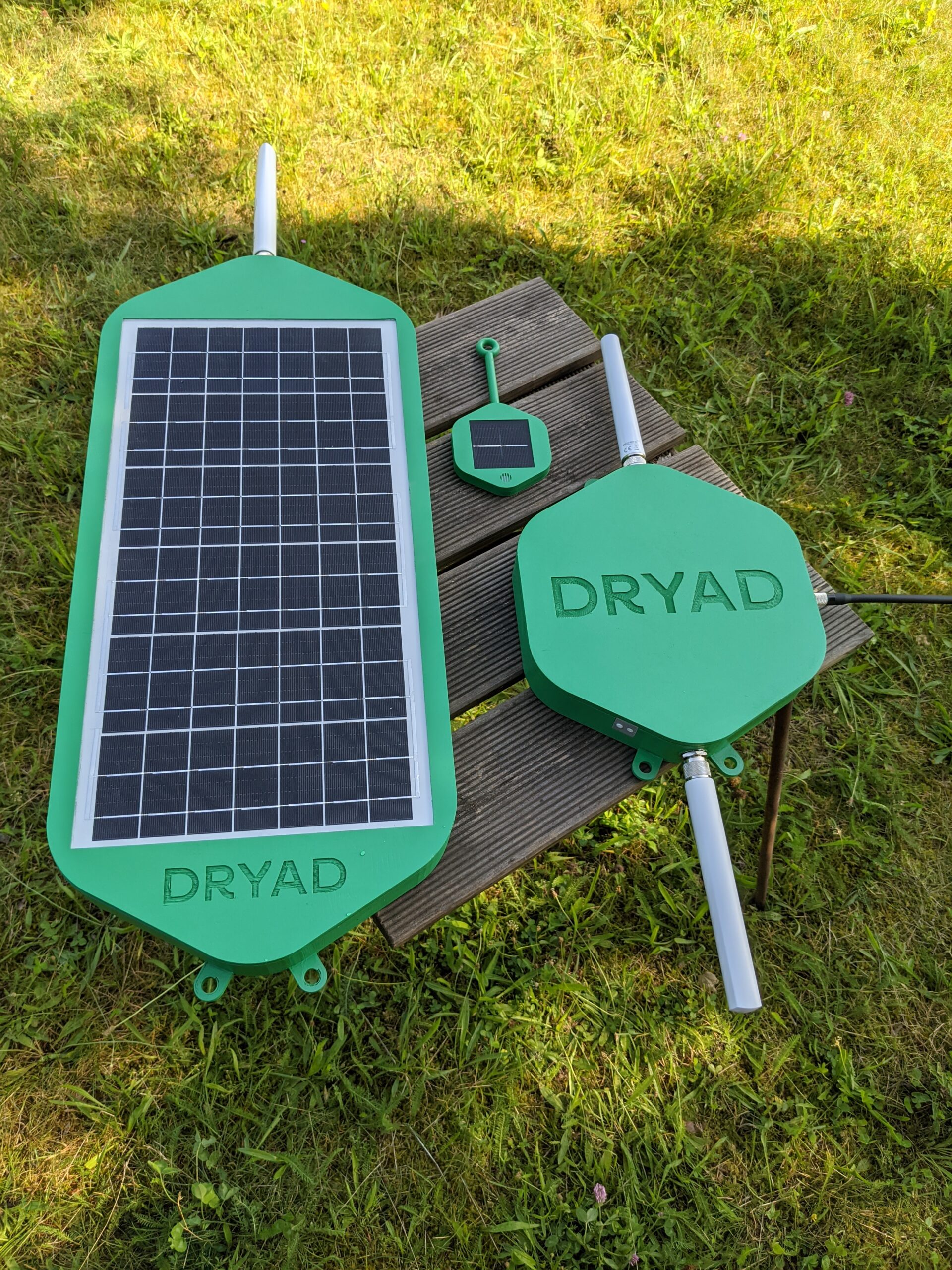
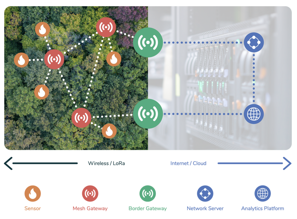
Another approach is to use gas sensors to detect wildfires. Gas sensors are small wireless devices attached to trees throughout the forest that can ‘smell’ a fire, akin to a ‘digital nose’. Once smoke is detected, the device sends a signal across the network to alert the authorities. One of the main benefits of gas sensors is that they can be embedded in the forest and can detect fires below the canopy layer while the fire is still in its infancy, allowing for quicker and more effective response and enabling fire fighters to extinguish a fire before it spreads out of control.
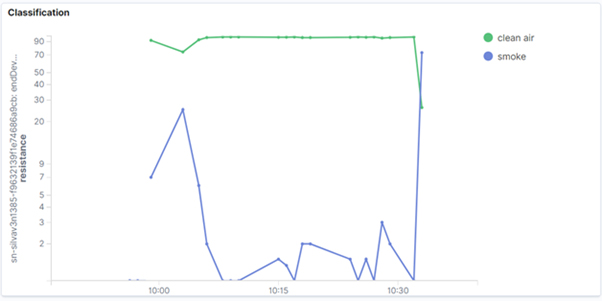
However, the sensor-based approach to detecting wildfires comes with its own set of challenges. To accurately ‘smell’ smoke, the devices are using machine learning (AI) models trained with data from fires and clean air taken from the forest environment. The challenge involves training the models to distinguish between the ‘smell’ of a fire and other ambient gases. For example, the smell of a forest can vary depending on factors such as the type of trees present, the time of day and even the season. Collecting a broad variety of data to provide a reliable machine-learning model can be a tedious challenge. Yet, by incorporating these variables into the training process, the AI models can become more resilient to false positives and more accurate in detecting actual fires. They can even be trained for a specific forest.
To train the machine-learning models, researchers create artificial environments in which they burn materials from target forests. The smoke generated from these controlled burns is then fed to machine-learning models to teach them what a fire actually ‘smells’ like. This process is repeated hundreds of times to improve the accuracy of the models. The more diverse the training data, the better the AI becomes at distinguishing between real fires and false positives.
For example, at Dryad, we constantly feed the model data about the natural, non-fire smells of a forest as well as the smell of smoke from a burning forest from our live site in Eberswalde, near Berlin. We also collect data from our many live sites across the world where the sensors are installed. All of this data is then compiled and used to constantly improve the models before pushing out an updated version to the devices, ensuring that they are always equipped with the latest detection capabilities.
Satellites and AI
Satellites have a great overview from above and can use cameras and infrared sensors to detect hotspots and wildfires from space. With the help of AI and image-recognition techniques, this process can be automated and authorities alerted when a fire is detected.
However, one of the key drawbacks with regard to wildfire detection is the resolution and the frequency of updates. Satellites used for detecting wildfires can be either geostationary (about 32,000km from Earth) or low-orbiting (about 600km from Earth). One pixel of a geostationary satellite image could cover as much as 500x500m, meaning a fire would have to be very big to show up at all. And once fires are very big, they become incredibly difficult to extinguish. Low-orbiting satellites, on the other hand, are closer to earth and can provide higher resolution (e.g. 100x100m), but as the Earth rotates underneath them, low-orbiting satellites can provide updates only every six hours for a given spot on earth. This can be mitigated by launching hundreds of satellites to get to frequent revisit times, but that would be quite costly given the relatively short lifespan of low-orbiting satellites.
What satellites excel at, however, is being able to predict the development and spread of wildfires by considering various factors such as terrain, wind direction and speed. AI and machine learning can be an immense help in predicting the development of wildfires by taking into account huge amounts of data to quickly build accurate models. This information can be passed along to firefighting and evacuation teams on the ground to help them coordinate efforts.
Summary
There is no silver bullet for containing the increasing threat of wildfires with technology. Each technical approach presents its own advantages and disadvantages. However, by combining and integrating the information from various detection methods, the advantages of one approach can cancel out the disadvantages of another. AI is a common theme across all solutions and will be able to help coordinate response efforts in real time.
For more information, go to www.dryad.net
About the Author

Carsten Brinkschulte
Carsten Brinkschulte is CEO and co-founder of Dryad Networks.Dryad provides ultra-early detection of wildfires as well as health and growth monitoring of forests using solar-powered gas sensors in a large-scale IoT sensor network. Dryad aims to reduce unwanted wildfires, which cause up to 20% of global CO2emissions and have a devastating impact on biodiversity. By 2030, Dryad aims to prevent 3.9m hectares of forest from burning, preventing 1.7bn tonnes of CO2emissions.

You must be logged in to post a comment.